


Discovering our Unseen Heritage: A Remote Sensing project

As you travel on foot or by car around Norfolk Island the evidence of our historic past is clearly on display. From fully restored buildings in World Heritage Listed Kingston to rubble remains in a paddock or back garden, our history, at least since British Settlement in 1788 can be seen virtually island-wide. Visitors are told our island’s history on daily tours of the visible remains. Locals growing up and living amongst the ruins have often been told the stories of past occupants and how the buildings and land were used.
However with the most recent comprehensive archaeological studies being conducted nearly thirty years ago there is much to update and discover including the possibility that previously unknown remains still lie buried in the ground, hidden from our view.
In 2014 the first steps to discovering our ‘unseen heritage’ began after a successful grant application was made by the University of Sydney to the Commonwealth’s Your Community Heritage Program to undertake the Norfolk Island Remote Sensing Survey. The Survey began on-island with the arrival of the team: Dr. Martin Gibb, Dr. Brad Duncan and PhD candidate Natalie Blake. Together these highly experienced professionals brought the necessary skills to gather and analyse data from as many sites as possible within the two short weeks of their visit. For staff at the Norfolk Island Museum it was a fabulous opportunity to work with the team and see first-hand how remote sensing techniques work.
There was no digging or excavation work carried out. Remote sensing is ‘non-invasive’ and the techniques used were Ground Penetrating Radar (GPR), Magnetometry and Resistance Survey. Archaeologists describe the results of remote sensing in terms of ‘anomalies’– a word we all came to enjoy using for the blips and squiggles appearing on monitors and print-outs, that are actually potential cultural features. As anyone can attest who has seen an episode of the popular British archaeological TV show Time Team, the important question of “where to dig?” appears to be made by huddles of archaeologists in heated debate interpreting the ‘anomalies’ found by the remote sensing workers! As it is not possible to confirm exactly what any anomaly might be without digging, the results of this Survey can be used to inform future excavation location decisions.
Along with ‘anomaly’ the word ‘potential’ is also another used to describe the results of remote sensing work. Without digging to confirm, every anomaly – no matter how obviously connected with a feature on a map – can only be considered as ‘potential’ until proven through excavation.
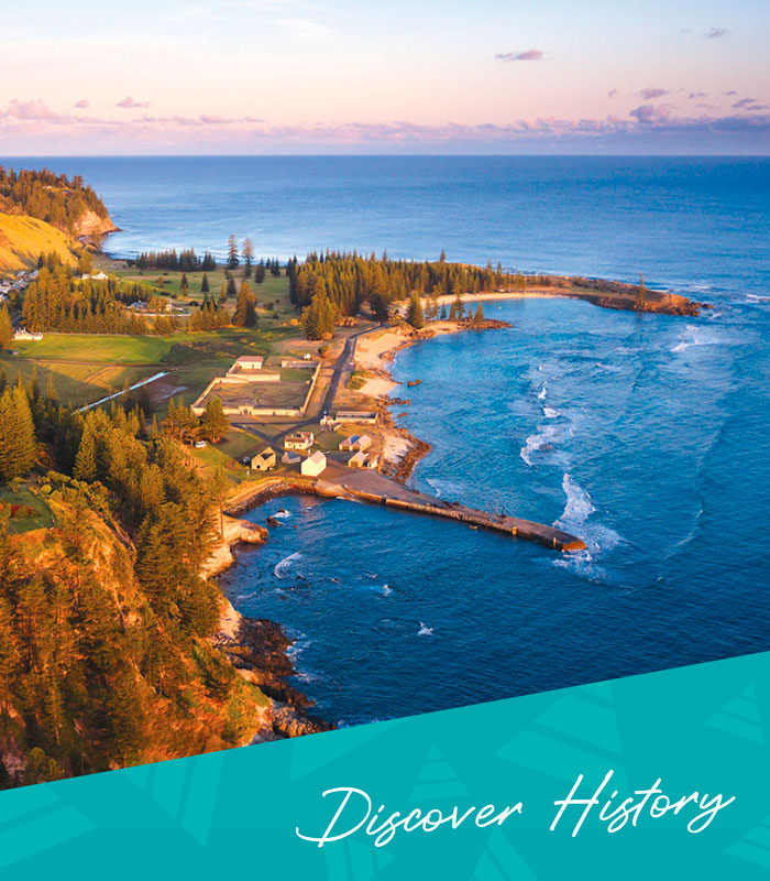
For the Survey team, before any equipment could even be unpacked decisions had to be made about where to survey. For such a small island Norfolk offers so many stories to explore with our rich history spanning from the Polynesian pre-history settlement (1300-1500), across both penal settlements (1788 to1814 and 1825 to 1855) to the Pitcairn settlement from 1856. Given the short time the team had on-island the final sites selected were: areas which may contain remains of First Settlement structures and features within the Pier area in KAVHA; the possible site of ‘Emily’s Grave’ in the First Settlement Graveyard area at Emily Bay; the unidentified burial site located above Cascade Pier; the original Melanesian Mission graveyard; Longridge Agricultural Station; and Cascade Agricultural Station.
A collection of historical maps, plans and aerial images dating from 1790 were geo-referenced by team member Dr. Brad Duncan. Geo-referencing is the computer aided precise scaling and overlay of historic maps, plans and images onto contemporary maps and plans and is an integral part of remote sensing. Dr. Duncan was effectively able to drape the historic maps over current landscape features and boundaries and then using Geographical Positioning Survey (GPS) accurately position and ground truth sites within the landscape – that is, he could truthfully match any location the team stood to its place on a historic map.
Starting with Kingston’s First Settlement Landing Place, Dr. Duncan’s overlay maps immediately identified that up to 40 metres of the ground where about twelve buildings had stood dating from both the First and Second Settlements, has been lost to shoreline erosion. Analysis of early plans by Chapman (1792 and 1795) and Grimes (1793) show the First Settlement’s orientation to be very different to the Second. It was formed around an avenue running from the Landing Place up to Government House, which would have been the first
and most dominant building to be seen upon arrival by sea. That view is starkly contrasted with the Second Settlement where the imposing walls of the New Gaol and Prisoners Barracks would be first sighted, clearly conveying that punishment was this island’s established intent.
The overlay maps also revealed that the current Second Settlement property boundaries are the same as for the First Settlement. It is therefore probable that a number of the structures from the First Settlement were still at least partially standing when the Second Settlement was being planned and their footings and remains were incorporated into the new buildings. This analysis upsets the commonly stated story that all First Settlement buildings were completely destroyed by 1814 at the end of the settlement.
A total of nine grids were surveyed between the Landing Place across to the New Gaol and Munna’s area. Across the area some of the potential finds were remains of: the 2nd Settlement Coxswains Quarters; a circular pipe or brick lined barrel drain relating to the 1795 Barracks; drainage or a former track used to access the Crankmill; the 1793-95 stone Courthouse; the 1793-95 Granary/ Storehouse, the 1792-93 Deputy Surveyors House; the 1795 Officers House or the 1839 Bakehouse; six co-joined Second Settlement Constables Cottages; the 1793 Provost Martial’s House and 1795 Officers House. Two parts of a possible wall intersected by the road were found that may have been part of the 1792-95 Gaol that was in this location. For all of our museum workers, after just three days of surveying we had a totally new appreciation of the land we daily walk over, little realising that so much lay right beneath our feet.
Arguably one of the most loved places by locals on Norfolk Island is Emily Bay. This beautiful beach however holds a mystery – how did it get its name after being changed around 1832 from Turtle Bay, and is it connected with the sole marking on an 1859 survey plan of “Emily’s Grave”? Stories of Emily being the wife of a soldier who drowned in the Bay and requested her own burial be in view of the beach have never been substantiated through historical records.
While the Survey team could not attempt to solve the question of who Emily was, they could however attempt to see if her grave still exists. Using surveyor John Brock’s 2006 identification of the most likely site of the 1859 marking, the team carried out a GPR survey. Despite being constrained by the presence of a pine tree and vegetation the results show that there is a definite anomaly in the correct location. Whether it is a grave is difficult to determine after 150 years of dune movement and the roots from the adjacent pine tree. Notwithstanding those cautions, it was hard not to feel just a little closer to ‘Emily’ with this encouraging result.
Two other GPR anomalies close by may also indicate other possible graves. They are also within the area of the First Settlement Burying Ground behind the western dunes of Emily Bay and located on maps from the mid-1790s. At that time burials commonly occurred close to the place of death, so it is not clear how many of the 262 free and convict men, women and children who died on the island during the First Settlement period were buried here. What is known is that over the years, human remains and sections of several headstones have been found in the waters of the Bay following severe storms. The entire Burying Ground area could definitely form the basis of future remote sensing projects.
Questions over early cemeteries on Norfolk are not only confined to Kingston. On the final bend of the winding drive down to Cascade Pier, a picket fence sits high on the ridge. In the 1980s workers drilling a hole for a power pole in this area pulled up human bones from a depth of less than 2metres. The pole was placed further up the slope, the bones re-buried and the area identified as a possible early cemetery for the First Settlement village of Phillipsburgh, located less than half a kilometre away.
Settlement began in this area from 1789, centering on attempts to cultivate the flax plant at nearby Cock Pit and free settlers clearing local land grants. While it seems logical that a settlement burying ground would have existed, the absence of any documentary evidence has meant that question has never been categorically answered. While it was hoped that remote sensing by the team could help with an answer, the limited space of the ridge made only GPR and resistance surveys possible. Working on such steep terrain, in long un-grazed grass and around the fence itself unfortunately resulted in little being learnt aside from one anomaly in the middle section of the fenced area that most likely is the re-buried remains. However without excavation and dating of the bones to confirm the period they might belong to – which includes the Polynesian period, we still do not know if this is just a lonely grave or part of a cemetery.
After completing the Cascade survey, the team moved further in-land investigating more recent events on Norfolk’s timeline. From 1866 to 1919 a Melanesian Mission run by the Anglican Church of New Zealand operated on the island, with the aim of training young Melanesians as teachers and clergy, who on return to their own communities would act as missionaries. Most of the students came from the Solomon Islands. The Mission had a large complex of buildings centered around St Barnabas Chapel. A graveyard was located on the opposite side of the valley and became the resting place for at least 118 people from the Mission. In the 1980s the graveyard’s deterioration led to the surviving headstones being moved to behind the Chapel and a commemorative monument erected on the original cemetery site listing all those known to have been buried there. While the identity of those graves can now never be confirmed, the Survey team felt that it would be fitting to try and identify the actual location of as many of the graves as possible. This however proved to be a difficult task with the results showing no distinct pattern of graves. Unfortunately the slope and dense grass made the magnetometer survey process difficult and often kept the GPR antenna 10-20cm above the ground surface (when it is meant to make close contact). Clay soils and saturated ground may have also interfered with signal returns. While the results were essentially unusable, a future return to this site could provide much better results – after a very close mowing and clearing of vegetation!
Both the Second Settlement Longridge and Cascade Agricultural Stations were large and complex. Due to time limitations remote sensing wasn’t carried out on these sites, however site visits were revealing. At the Cascade Agricultural Station site the substantial remains of a horizontal windmill was investigated. While these structures were known in the UK, they were not common. The one on Norfolk Island remains mysterious as no previous reference could be found to its construction. A single plan and an undated, unidentified photograph of a painting of the structure comprise all that is known of its construction.
The Longridge Agricultural Station largely built between 1839 and the mid 1840’s comprised over 35 structures and areas. Today, as planes take-off from the southern end of the runway, most passengers would not be aware that they are travelling over the site of the former Superintendent’s House. Construction of the strip demolished the northern end of the settlement, but the remains of many structures can still be seen by driving down Bumboras Road. The purpose of the Station was to provide Commandant Alexander Maconochie with a place to implement his reformist principles on newly arriving convicts, keeping them away from the influence of the hardened ‘older hands’ accommodated and working in Kingston.
While the location of visible remains in this area are commonly known, this Survey provided the first accurate confirmation of the identity of many structures and also surprisingly revealed the existence of previously unknown, or at least undocumented remains. This was achieved by geo-referencing an 1846 Plan by Mountney. Using the geo-referenced map in conjunction with the location of visible remains, the team was able to perfectly predict where hidden remains lay by simply pacing out the distances between the buildings.
The results of both the Longridge and Cascade Agricultural Stations highlighted that each of these areas could easily warrant their own two week investigation. As with all the other sites surveyed, it was revealed that there is still so much left to discover, to build on our knowledge and understandings across all the settlements and peoples who have lived on this island. This Remote Sensing Survey has well and truly began that journey, uncovering our unseen heritage and providing us with the realisation of just how much still lies beneath our feet.
____
Image Credit: Robin Nisbet
www.robinnisbet.com
____
Article content disclaimer: Article first published in YourWorld, Volume 04 Issue 02, 2014. Please note that details of specific travel, accommodation and touring options may be outdated. References to people, places and businesses, including operating days and times may be have changed. References to Government structure and Government businesses/entities may no longer be applicable. Please check directly with businesses and/or Government websites directly rather than relying on any information contained in this article before you make travel arrangements.