


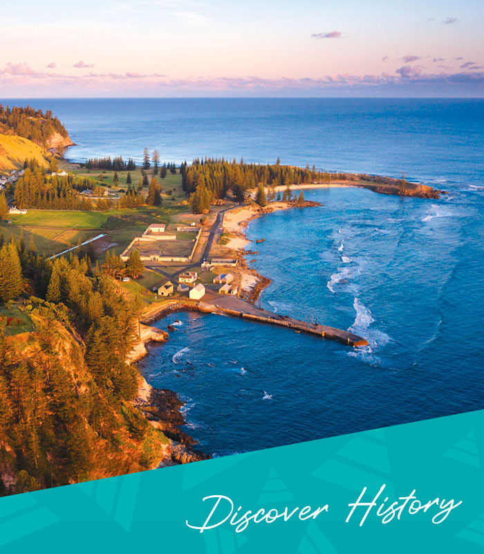

The Seven Bridges of Kingston

Bloody Bridge, Bounty Street Bridge, Pier Street Bridge, Canal Bridge, New Bridge, Old Bay Street Bridge, Bligh Street Bridge.
Seven bridges, seven names that evoke almost every chapter in the long and romantic story of Norfolk Island’s capital and Australia’s second-oldest town. Seven bridges, one great walk around Kingston.
The most easterly is Bloody Bridge, tucked away at the eastern gateway to the Historic Area, on Driver Christian Road. Apart from its picturesque location in Music Valley, beside a grove of old Norfolk Island Pines that shelter a seasonal Bosunbird breeding ground, the name of Bloody Bridge always draws attention. According to folklore the convicts building the bridge drew lots to murder their unpopular overseer, murdered him and buried the body in the foundations. His blood stained the stone work and revealed their crime, after which the killers were sent to Sydney where justice was swift and ultimately fatal. However, there is no record of any such event taking place, and a more prosaic explanation maybe that it was named by Irish convicts after Bloody Bridge in Dublin. The name and a story was probably told by the convicts to the Pitcairners in 1856, as described by a visitor on HMS Fawn in 1860 who wrote of the new residents telling visitors just such stories to illustrate the brutality that had shaped the convict landscape they inherited in 1856. In 1885 John J Spruson published a history of Pitcairn, Lord Howe and Norfolk islands that contains the earliest published version of the convict murder story for the bridge’s name.
By 1790 the road from Kingston to Ball Bay crossed the creek here, running through a vale of vegetable gardens. About 1832 construction of the bridge began, using convict labour. A creek channel was defined, and the oviform (egg-shaped) vaulted bridge tunnel was built. A coral stone wall was built on each side, each with six buttresses, and then the void was filled with rubble and soil. Raised causeways connect the bridge to the adjoining roadway, so that the whole structure stands high above the little flood plain of Music Creek. The road surface was sealed by the 1970s, keeping the carriageway between the grass verges that continue across the bridge surface. These causeways and grass verges are characteristic of all the larger bridges of Kingston. In about 1914 the western wall of the bridge collapsed, and was rebuilt in 1917 in the splayed or faceted form that still shows the extent of the collapse even today, and which reduced the width of the bridge deck by half.
Pier Street Bridge is the most westerly of the bridges. It was built in 1831, and connects Quality Row to the Landing Place by a long causeway called Pier Street. A ford had been built over Watermill Creek on this alignment by 1796 when the route was called the ‘Road to Phillipburg’ (now Cascade), and it remains one of the oldest roads still in use in Australia. By 1829 Pier Street was following its present alignment, and construction of the causeway and the bridge began soon after. The causeway sits two to three metres above the ground level and when completed provided for the first time dry all-weather access between the landing place and the rest of the island. The bridge and street name indicates the importance of this connection, although the pier was not completed until some 15 years after the bridge. Whether its convict builders ever gave the bridge a name is not yet known. Pier Street Bridge, like Bloody Bridge, has a central vaulted channel made of massive coral stone. The walls of the bridge and causeway are built of rubble coral stone, and infilled with more rubble and soil. The roadway runs between grassed verges that cross the bridge, with regularly-spaced limber holes to drain rain water away from the road surface. Unlike Bloody Bridge, no buttresses were needed to support these walls, possibly because they are not of such a great height, but they have a slight batter similar to the walls of the pier to deflect flowing water away from the causeway and through the bridge tunnel.
Two hundred metres eastwards is Bounty Street Bridge, built about 1832 after the completion of Pier Street Bridge. Whereas Bloody Bridge and Pier Street Bridge both have a round arch tunnel, Bounty Street Bridge shows a fine elliptical (a flattish curve) four-metre wide arch. Unfortunately, the bridge has suffered much damage to its eastern face, which was largely rebuilt, probably in the late 1930s after flood damage, when the arch was replaced by a flat concrete lintel. The western face still retains its original arch, with fine segmented stonework. The street provided rapid access during times of trouble from the New Military Barracks on Quality Row to the Prisoner’s Barrack and the prisoner’s mess on Bay Street. There was also a long terrace and several cottages around the northern end of the street for constables and overseers who also needed easy access to the convict quarter. Its current name of Bounty Street dates from 1904, and reflects the later Pitcairner settlement of the town. The causeway on either side of the bridge is very short in length. In recent years the northern end of the bridge and its causeway have been sinking and is now over a metre lower than the southern end. An ongoing monitoring program is currently in place to measure the bridge’s movements, and eventually to inform conservation works to stabilize and possibly reverse the sinking.
Another two hundred metres further eastwards and the creek channel dissipates into several channels, forming a sort of delta where the waters from Watermill Creek, Town Creek and Government House Rill meet. During wet weather this area is a bird lover’s paradise, and a sense of the old primeval Kingston Marsh that once covered most of the Kingston Common can still be experienced.
The current formal entrance to Government House on Quality Row masks the existence of Bligh Street constructed in 1831. The street formerly ran from Quality Row through to Bay Street, parallel to Bounty and Pier streets, and at least three crossings were needed for it to traverse the marshes. The southern end of the street is really a long causeway with various stone-built crossings to allow for the passage of water. The name Bligh Street Bridge today refers to the original stone bridge that can still be seen in place, near the ruin of another stone bridge that formerly crossed the Serpentine. The causeways through the marshes around this area were formed by earthen embankments without stone retaining walls, perhaps due to difficulties in locating firm bedrock. Bligh Street Bridge is built of rubble coral stone abutments with a large slab of massive coral stone spanning the channel. Rubble parapets sit on the edges of this slab to provide sides to the roadway, which is now entirely covered with a thick layer of soil and turf. Bligh Street runs directly from the Old Military Barracks entrance to Bay Street, and may have been first formed to move stone and lime from the quarries and lime kilns on Bay Street to the Barracks construction site. Once competed, Bligh Street, like Bounty Street, provided rapid access for the military to the convict quarter along Bay Street, as well as from 1838 a new formal entrance to Government House. Like Bounty Street, the name Bligh Street dates from 1904, and it is the only place name in Kingston commemorating a former viceroy. It provides a street address for Australia’s oldest vice-regal residence, and it forms a name-pair with Bounty Street, commemorating in their street and bridge names the legendary captain and mutiny of 1789.
Another 20 metres along the channel is Old Bay Street Bridge. Now a pedestrian timber bridge sits on the site, but evidence of the older bridge can be clearly seen in the rubble coral stone bridge abutments. There may have been a ford at this site since 1802 when construction of Government House began. It is located on the Old Bay Street embankment or causeway that curves northwards and runs along the base of Chimney Hill, across the marshes and up to Government House. The street was raised on the earthen embankment that can still be seen, and the stone bridge abutments were built between 1825 and 1835, with a timber deck, presumably of Norfolk Island Pine, used to span the creek. The lightest of the bridges, it was only used for a few years until about 1838 when the new Bligh Street entrance to Government House came into use, and this section of Bay Street was reduced to a lane for separate access to the stockyards and gardens behind Government House.
Bay Street had split into two arms at Chimney Hill, and while this northern arm became a back lane, the southern arm survives as Bay Street proper. It had come into use in the 1790s when the quarry and lime kilns were being developed, and the first burying ground was set aside. The first attempts to drain the marshlands began in the early 1789 when a channel was cut through the limestone saddle that connected Doves Plot Hill (the site of Government House) and the Chimney Hill ridge and then ran along its eastern side to drain into Emily Bay. This separated the burying ground from the rest of the town, and required the building of a ford or bridge to re-connect them. The channel was known as ‘the canal’, and the name of Canal Bridge reflects this earliest phase in the draining of the marshes.
The northern section of the canal running around Chimney Hill was filled in during the 1830s, while the southern reach was rebuilt and the current bridge built in about 1835, possibly incorporating the earlier 1789 bridge over the canal. Like Bloody Bridge and Pier Street Bridge, a vaulted channel was built of massive coral stone, this time with a pointed arch, and rubble walls filled with soil to road level. Two small buttresses support the bridge wall on its northern side, and the stone walls on the canal are connected to the bridge structure. This is the smallest and narrowest of Kingston’s bridges, and it and the New Bridge are the only ones spanning a waterway affected by the ocean tides.
Just a few metres away is the New Bridge, adjacent to the old lime kilns. As the name suggests, this is the newest of Kingston’s road bridges, dating from 1941. The concrete-lined channel was built between 1937 and 1941 following severe flooding in 1936. It provided a straight cut across the marshlands and through the southern end of Chimney Hill that was intended to quickly drain away into Emily Bay any build-up of water in the marshes. The bridge consists of a reinforced concrete deck that sits directly on coral stone abutments formed by cutting the channel straight through the natural rock. The timber rails that provide a safety barrier on each side have been replaced several times over the years. The soil excavated for the channel was spread over the marshlands to raise the ground level, almost burying the Bligh Street bridges. The channel and bridge show the earliest use of concrete on a large-scale public works project on Norfolk Island, and illustrate the changes in bridge building technologies since the 1830s
A Kingston bridges walk will reward the rambler with many different views across Kingston, a variety of environments from the open Common to elegant street vistas to the more intimate groves of Norfolk Island Pines, a mix of oceanic, wetlands and forest birds, and of course the ever-present Georgian townscape and the brooding ruins of another age.
It is possible to make a circuit of the bridges without ever having to cross any bridge more than once – provided that you don’t stick to the sealed roads and can make a few cross-country diversions. A walk around the seven bridges of Kingston will take you across town – and time.
____
Image Credit: Bloody Bridge – Robin Nisbet
www.robinnisbet.com
____
Article content disclaimer: Article first published in YourWorld, Volume 01 Issue 04, 2011. Please note that details of specific travel, accommodation and touring options may be outdated. References to people, places and businesses, including operating days and times may be have changed. References to Government structure and Government businesses/entities may no longer be applicable. Please check directly with businesses and/or Government websites directly rather than relying on any information contained in this article before you make travel arrangements.